Why Google Maps Doesn't Work in Korea (And What to Use)
Google Maps is restricted in Korea due to national security laws that prevent high-precision map data from being exported to global servers.
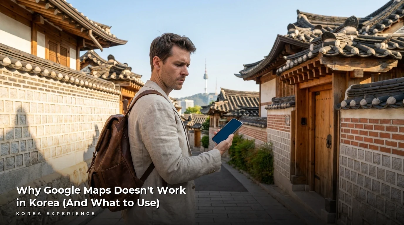
You've just landed at Incheon International Airport, your bags are packed with dreams of K-beauty hauls and street food, and you pull out your phone to find the way to your hotel. You open Google Maps, type in your destination, and... nothing. No walking directions. No turn-by-turn driving guidance. Just a lonely blue dot on a very blurry map. It's a frustrating "Welcome to Korea" moment that almost every traveler experiences. The short answer is that Google Maps is crippled in South Korea because of strict national security laws that prevent high-precision map data from being stored on overseas servers. Because Google refuses to move its mapping data onto servers physically located within Korean borders, the government restricts them to a low-detail map that simply cannot support the navigation features you're used to back home.
Key Takeaways
- 1South Korea classifies high-precision (1:5,000 scale) map data as a national security asset and prohibits its export to global servers; since Google processes data offshore, it is restricted to a low-detail 1:25,000 map
- 2As of March 2025, Naver Map leads the market with 27.05 million monthly active users, while Google Maps is a distant fourth with roughly 9.22 million users
- 3To navigate effectively, visitors should download Naver Map or KakaoMap, both of which offer full English interfaces and real-time transit data that Google lacks
The Geopolitical Standoff: Why Your Map is Blank
The primary reason Google Maps is effectively "broken" in South Korea comes down to a fundamental clash between global tech infrastructure and localized national security laws. Under the Spatial Information Management Act, the South Korean government restricts the export of "high-precision" map data (anything more detailed than a 1:25,000 scale) to servers located outside the country. The Korean National Geographic Information Institute (NGII) maintains a 1:5,000 scale map—the "digital oil" that powers modern navigation—but they refuse to hand it to Google unless it is stored on servers physically located within South Korea.
Google, which processes its mapping data through a centralized global cloud, has repeatedly refused to build a dedicated local data center for Korea. This means that while Google can show you basic roads and city names, it lacks the precise geometric data—like the exact curvature of an alleyway or the location of a building entrance—required to calculate turn-by-turn walking or driving routes. Essentially, the "brain" of Google Maps is located in California, while the law requires it to be in Seoul.
Furthermore, because South Korea remains technically at war with North Korea under an armistice agreement, the government is hyper-vigilant about geographic data. High-precision maps could theoretically be used by hostile actors to pinpoint the coordinates of sensitive military sites or the presidential Blue House. While domestic companies like Naver and Kakao are allowed to use this data, they do so under strict government oversight, including the mandatory "masking" or blurring of military installations—a compromise Google has only recently expressed a willingness to implement.
📋 Korea Mapping at a Glance
Deep Context: Two Decades of Digital Sovereignty
The "Map Wars" between Google and South Korea have spanned nearly two decades, involving three failed formal requests and significant geopolitical pressure. Google's first attempt to export data in 2007 was flatly rejected on security grounds. A second attempt in 2016 faced similar hurdles, with the government demanding that Google blur satellite images of military bases as a prerequisite—a condition Google initially rejected, citing that the images were already commercially available from other global satellite providers.
By 2025 and 2026, the argument has shifted from purely security-based to a question of "Digital Sovereignty." A major economic study presented in early 2026 warns that approving Google's request without robust safeguards could cost the South Korean economy up to 197 trillion won ($136 billion) over the next ten years. The fear is that foreign platforms will dominate the market, leading to a massive outflow of royalty payments for mapping APIs that local developers currently pay to domestic firms like Naver.
This has created a complex trade friction between Washington and Seoul. The U.S. government has officially labeled Korea's map restrictions as a "non-tariff trade barrier," arguing that it unfairly shields domestic giants like Naver and Kakao from global competition. As of February 4, 2026, the government is entering final-stage talks, with officials hinting at a "split decision" that might favor Apple (which maintains some local server infrastructure) over Google.
The Google Maps vs. Korea Standoff
First Rejection
Government rejects Google's first formal request citing security risks near the DMZ
Second Denial
Authorities refuse 1:5,000 scale data request, demanding local server infrastructure
Third Request
Google files third formal request, citing tourist complaints as primary motivation
Final Deadline
NGII sets deadline for Google to submit security masking documentation
Comparing Your Options: The Local Super Apps
In the absence of a functional Google Maps, South Korea has developed one of the world's most sophisticated domestic mapping ecosystems. Travelers have three main choices: Naver Map, KakaoMap, and T-Map. Naver Map is the undisputed king of the industry, with over 27 million monthly active users. It is the most foreigner-friendly option, providing detailed English navigation and integrated "Place" data that includes everything from restaurant menus to real-time bus crowding levels.
The best alternative is Naver. Learn about using Naver Maps like a local.
KakaoMap is the fastest-growing alternative, with an 11.71 million user base as of March 2025. It is highly regarded for its "hyper-local" services, such as "Expert Profiles" that connect users directly to local specialists like bakers or florists within the app. While its English support has historically been more limited than Naver's, it remains a favorite for its minimalist design and deep integration with the KakaoTalk messaging app.
Finally, for those planning to drive, T-Map is the local standard. With 14.96 million users, it is the leading mobility platform for car navigation. It integrates advanced AI—rebranded in 2025 as a "conversational mobility agent"—that allows drivers to use natural language commands like "Find me a good raw fish restaurant nearby and then go home." While T-Map is powerful, its English interface is significantly less developed than Naver Map, making it a better choice for expats than short-term tourists.
Driving in Korea? Navigation is critical. Read our guide to renting a car in Korea with navigation app tips.
Navigation App Comparison (2026)
| Feature | Naver Map | KakaoMap | Google Maps |
|---|---|---|---|
| Walking Directions | Full Turn-by-Turn | Full Turn-by-Turn | Dotted Line Only |
| Real-time Bus/Subway | Yes (High Accuracy) | Yes (High Accuracy) | Limited/Delayed |
| English Interface | Strong (App & Nav) | Strong (App only) | Good |
| Restaurant Booking | Yes (Integrated) | Yes (Hyper-local) | No |
| Driving Navigation | Yes (English) | Yes (English) | No |
| Map Precision | 1:5,000 | 1:5,000 | 1:25,000 |
Naver Map Analysis for Travelers
- ✓Comprehensive local data including detailed menus, blog reviews, and real-time crowding info
- ✓Superior English support for turn-by-turn walking and driving directions
- ✓Integrated payment features (Npay Connect) that allow tourists to pay using international cards
- ✗Search results can be inconsistent if you don't use the exact Romanized name
- ✗The interface is feature-heavy and can drain battery faster than minimalist apps
- ✗Street View (Road View) is hyper-accurate but can be overwhelming for first-time users
Practical Guide: Mastering Naver Map
Navigating Korea with Naver Map requires a slightly different approach than the "plug and play" nature of Google. The first hurdle is the search function. Because English Romanization of Korean addresses is inconsistent (e.g., "Gyeongbokgung" vs. "Kyungbokkung"), the app can sometimes fail to find a location typed in English. The "Pro" way to navigate is to find the Korean name of your destination on a site like TripAdvisor or VisitSeoul, copy the Hangeul (e.g., 어니언 성수), and paste it directly into the search bar.
Once you have your destination, Naver Map provides a level of detail that Google cannot match. For public transport, it doesn't just show the bus number; it tells you exactly how many minutes until the next two buses arrive and how "congested" they are. For the subway, pay close attention to the "Fast Transfer" car numbers (e.g., 3-4) listed in the route details; these tell you exactly where to stand on the platform so you are perfectly aligned with the stairs or escalator at your transfer station.
Walking directions are also far superior. Naver Map includes precise walking paths through small alleys and even shows the specific entrance of a building. If you find yourself disoriented, use the "CCTV" feature (available by tapping the layers icon) to see real-time video feeds of nearby major intersections, which can help you verify traffic conditions or the weather before you step out.
📖 How to Set Up Naver Map in English
Step 1: Download and Installation
Search for 'Naver Map' on the Apple App Store or Google Play Store. Install and open the app.
Step 2: Access Language Settings
Tap the menu icon (☰) in the top left corner of the screen. Look for the gear icon (Settings) and tap it.
Step 3: Select English
Find the 'Language' (언어) menu. Select 'English' from the options. The app will usually require a restart to apply the interface changes.
Step 4: Test Your Search
Type 'Gyeongbokgung' in English. The app should suggest the palace. Switch between 'Walking' and 'Public Transport' to see the turn-by-turn guidance.
The Copy-Paste Trick
If a search doesn't work in English, find the Korean name of the place on Instagram or Google, copy it, and paste it directly into Naver Map. This is 100% more reliable for smaller cafes and boutique shops.
Google Maps shows you where a building is, but Naver Map shows you where the door is. Always check the 'Subway Exit' feature in the app—in Seoul, taking Exit 1 instead of Exit 10 can add 20 minutes to your walk underground!
Edge Cases: Taxis, Payments, and Workarounds
One of the biggest frustrations for travelers is the "Real-Name Verification" system required for many Korean apps. For years, booking a restaurant or calling a taxi via Kakao T required a Korean phone number and an Alien Registration Card (ARC). However, by 2026, several "workarounds" have become standard. Uber (rebranded locally as UT) works seamlessly with international credit cards and phone numbers, allowing you to hail regular local taxis without a Korean ID.
For payments and bookings, the Npay Connect platform has been a game-changer. Launched as part of a 2025 partnership between Naver and the Korea Tourism Organization, these universal terminals have been rolled out across major tourist hubs like Myeong-dong and Gyeongju. Travelers can now use Apple Pay, contactless NFC cards, and international credit cards at these terminals, and you can search for "Connect" stores directly within Naver Map to ensure you're heading to a place that accepts your payment method.
Finally, don't forget the subway stations themselves. Many of Seoul's larger stations have over 10 exits spread across several city blocks. Google Maps often just points you to the "station," but Naver Map will specify "Exit 5." If you are meeting someone or heading to a specific shop, always confirm the exit number beforehand—it could save you 15 minutes of wandering through underground shopping malls.
Watch Your Step
Motorcyclists in Korea frequently drive on sidewalks, especially in delivery-heavy areas like Hongdae or Seongsu. Google Maps doesn't account for these pedestrian-path risks, so keep your head up while following digital directions.
No Korean Phone Number?
As of 2026, look for the "Npay Connect" logo in shops. This terminal system was expanded to help tourists pay with international credit cards or Apple Pay directly through the Naver Map ecosystem, bypassing the old requirement for a Korean ID (ARC). For taxis, use Uber (UT) which works with your existing foreign phone number.
Conclusion
Google Maps is unlikely to provide a full navigation experience in South Korea anytime soon. The February 5, 2026, deadline for Google to submit supplemental security documentation marks just the latest chapter in a saga defined by national security concerns and a fierce desire for digital sovereignty. While this may be an inconvenience, it is also an opportunity to experience Korea's hyper-advanced local tech. By downloading Naver Map and utilizing the new Npay Connect payment ecosystem, you gain access to real-time data and local insights that Google simply cannot provide.
Our clear recommendation: Save Google Maps for your next trip to Europe or the US, and embrace the local "Super Apps" to truly unlock the best of South Korea.
❓ Frequently Asked Questions
Have more questions?Contact us →
For getting around without maps, see our guide to Korean taxi apps including Kakao and Uber alternatives.
Sources
- Korea Herald - Comprehensive report on the 2025-2026 map export standoff
- Seoul Shopper - Practical guide for travelers using local alternatives
- Korea Tech Today - Latest 2025/2026 market share and feature data
- Business Korea - Information on the February 5, 2026, government deadline for Google
- Trip.com Guide - Step-by-step instructions for foreign users in 2026
About the Author
Korea Experience Team
Written by the Korea Experience editorial team - experts in Korean medical tourism, travel, and culture with years of research and firsthand experience.
Explore more in Travel & Tourism
From Seoul's neon-lit streets to Jeju's volcanic landscapes — discover the best of Korea with insider travel tips, itineraries, and seasonal guides.
Browse All Travel & Tourism ArticlesContinue Reading
Explore more articles you might find interesting

Planning a trip to the edge of North Korea this year? Here is everything you need to know about the current JSA closure, the brand-new 2026 transit rules.

Choosing the best tourist card in Korea for 2026? This data-backed comparison of T-Money, Wowpass, and Namane will guide your decision for travel and payments.

So, you're landing at Incheon Airport in 2026 and everything looks different—Asiana has moved, your face is now your boarding pass.

Discover the best Kakao T alternatives for tourists. Learn how to use Uber, TADA, and street hailing hacks without a Korean SIM card.

In 2026, you can absolutely rent a car in Jeju without an ARC—but only if you have an International Driving Permit (IDP) and navigate the new 'e-Arrival...

Unpack the real cost of a 7-day trip to Korea in 2026. This guide details budget to luxury expenses for flights, hotels, food, and activities.