Hiking Seoul's Big Three: Bukhansan, Gwanaksan, and Dobongsan guide 2026
Master Seoul's top peaks in 2026. Complete guide to Bukhansan (836m), Gwanaksan, and Dobongsan with trail maps, transport costs under ₩2,000, and safety tips.
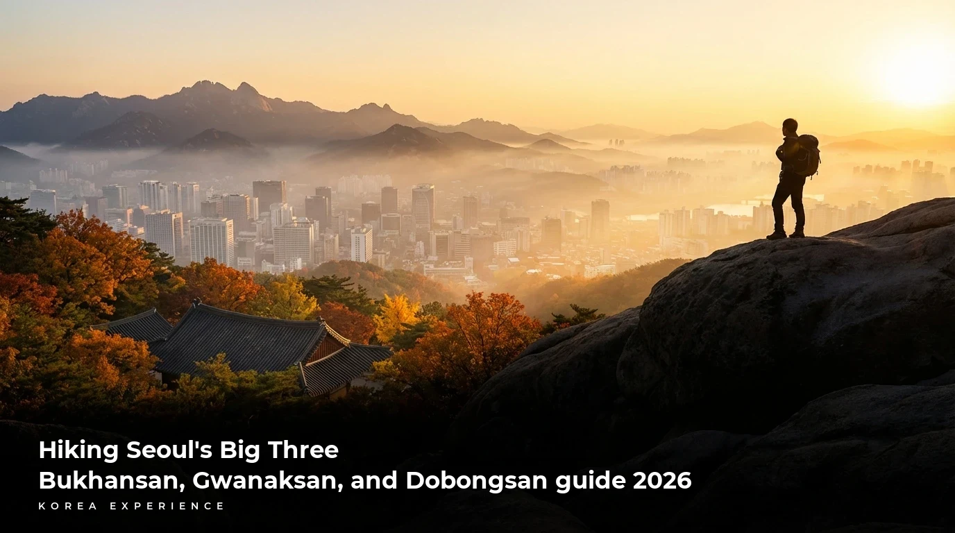
Seoul offers a hiking experience unlike any other major metropolis in the world. The "Big Three"—Bukhansan, Dobongsan, and Gwanaksan—are the crown jewels of the city's topography, offering distinct challenges ranging from 632 meters to 836 meters in elevation. For international travelers in 2026, these mountains are not just physical challenges; they are cultural immersion points where history, nature, and the local "dwipuri" (after-hike party) culture converge. Each mountain is accessible via the Seoul Metropolitan Subway system for a fare of approximately ₩1,400 to ₩1,600, making world-class trekking available for less than the price of a cup of coffee.
The short answer: Bukhansan (836m) is the tallest and most iconic with fortress walls; Dobongsan (740m) offers the most dramatic rocky peaks and technical challenges; and Gwanaksan (632m) provides the best accessibility to Gangnam with stunning southern city views.
Key Takeaways
- 1Bukhansan is the most popular choice, attracting over 5 million visitors annually, with the Baegundae Peak trail taking 4-5 hours round trip.
- 2Dobongsan's Y-Valley course requires upper body strength and proper hiking boots due to steep metal handrails and rocky terrain.
- 3Gwanaksan is easily accessible via the Sillim Line (opened recently), reducing approach time by 20 minutes compared to previous years.
Why Hike in Seoul? The Unique Appeal
Hiking in Korea is a national pastime. On any given weekend, you will see thousands of locals geared up in premium hiking attire, heading to the trailheads. The infrastructure is world-class: trails are well-marked, emergency markers are placed every 250-500 meters, and cellular service is available at the peaks of all three mountains.
What makes the "Big Three" special is their proximity to urban life. You can stand on the granite peak of Bukhansan, looking down at a city of 9.4 million people, and be back in downtown Seoul eating Korean BBQ within 90 minutes. In 2026, the hiking culture has evolved to include more younger demographics (MZ generation) seeking "Instagrammable" spots, leading to better cafe infrastructure near trail entrances.
📊 Hiking Popularity in Seoul
1. Bukhansan National Park: The Crown Jewel of the North
Bukhansan (North Han Mountain) is the only national park located within a city district in the world. Standing at 836 meters (2,744 feet), its highest peak, Baegundae, offers a 360-degree panoramic view that stretches to Incheon on a clear day.
The Baegundae Peak Course
This is the most popular route for first-timers. It is challenging but manageable for anyone with a moderate fitness level. The trail begins relatively gently but becomes steep and rocky towards the summit.
📋 Bukhansan Baegundae Course Facts
Getting There: Take Subway Line 3 to Gupabal Station, Exit 1. Transfer to Bus 704 or 34, which runs every 10-15 minutes. Get off at the Bukhansanseong Fortress Entrance stop. The bus fare is ₩1,500.
The Climb: The hike starts on a paved road leading to the trailhead. About 40 minutes in, you will reach the Borisa Temple. From here, the path splits. The left path is steeper but faster; the right follows the valley and is more scenic. Most hikers choose the valley route up and the steep route down.
At the 600-meter mark, you encounter the Ui-mun Gate, part of the ancient fortress wall built during the Joseon Dynasty to protect the capital. The final 300 meters to the summit involve pulling yourself up using steel cables bolted into the smooth granite. It can be a bottleneck on weekends, with wait times of 15-20 minutes to take a photo at the summit flag.
Weekend Crowds
Bukhansan is extremely crowded on Saturdays and Sundays between 10:00 AM and 2:00 PM. To avoid the "human traffic jam" on the cables, start your hike at 7:00 AM or go on a weekday.
Historical Significance
Bukhansan isn't just rock; it's history. The Bukhansanseong Fortress spans approximately 12.7 kilometers along the ridges. As you hike, you are walking along walls that have stood since 1711.
Bukhansan Baegundae Peak(북한산 백운대)
2. Dobongsan: The Rugged Rock Garden
Located just northeast of Bukhansan, Dobongsan is arguably the most aesthetically striking of the three. Its name means "Tao Peak Mountain." While slightly shorter than Bukhansan at 740 meters (2,427 feet), many hikers find it more physically demanding due to the jagged nature of its peaks: Manjangbong, Seoninbong, and the highest, Jaunbong.
The Y-Valley Course (Advanced)
Dobongsan is famous for the "Y-Valley," a steep, V-shaped crevice that requires hikers to scramble down one side and up the other using metal handrails. This section is not for those with acrophobia.
📖 Conquering Dobongsan's Jaunbong Peak
Step 1: Arrival
Take Subway Line 1 or 7 to Dobongsan Station, Exit 1. The trail entrance is a bustling street lined with gear shops and food stalls.
Step 2: The Approach
Follow signs for Cheonchuksa Temple. The path is steep stairs and rocks.
Step 3: Madangbawi (Garden Rock)
A massive flat rock offering a great rest stop and photo op about 70% of the way up.
Step 4: The Summit Push
The final ascent to Jaunbong is vertical. You cannot stand on the very tip of Jaunbong (it's too dangerous), so hikers congregate on the adjacent Sinseondae terrace.
Why Choose Dobongsan?
If you want to see the "bones" of the Korean landscape, Dobongsan is the choice. The exposed granite formations are dramatic and photogenic. It also tends to have a slightly older demographic of serious hikers compared to the mix at Bukhansan.
Dobongsan vs. Bukhansan
- ✓More dramatic rock formations
- ✓Slightly less crowded than Bukhansan
- ✓Excellent food alley at the station entrance
- ✗Steeper and more technical
- ✗Y-Valley can be terrifying for beginners
- ✗Fewer 'easy' escape routes if tired
For those interested in capturing the stunning autumn foliage against these grey rocks, check out our guide on best hiking and photography spots for seasonal timing.
3. Gwanaksan: The Guardian of the South
Gwanaksan stands at 632 meters (2,073 feet) and guards the southern flank of Seoul. It borders the Gangnam district and the city of Anyang. While it is the shortest of the Big Three, do not underestimate it. The trails can be rugged, and the ridge lines are exposed.
The Yeonjudae Peak & Temple
The highlight of Gwanaksan is Yeonjudae, a small hermitage built precariously on top of a cliff face near the summit. It is one of the most photographed temples in Korea due to its impossible location.
Getting There: The accessibility of Gwanaksan improved significantly with the opening of the Sillim Line.
- Option A (The Ridge): Take the Sillim Line to Gwanaksan Station, Exit 1. This starts near the main university entrance.
- Option B (The Sadang Ridge - Harder): Take Line 2 or 4 to Sadang Station, Exit 4. This route follows a long, rocky ridge with spectacular views of Gangnam's cityscape.
Route Comparison: Gwanaksan
| Feature | SNU Entrance Route | Sadang Ridge Route |
|---|---|---|
| Difficulty | Medium | Hard |
| Time | 3 Hours | 4.5 Hours |
| Scenery | Valley & Stream | City Skyline & Rocks |
| Crowds | High | Moderate |
The "Silicon Valley" View
From the top of Gwanaksan, you look directly down into the Gwacheon Government Complex and the southern suburbs. Looking north, you see the Lotte World Tower piercing the sky. It offers the best perspective of Seoul's modernity contrasting with nature.
"If you hike Gwanaksan in May, the royal azaleas are in full bloom near the entrance. However, bring plenty of water. The ridge course from Sadang has zero water sources until you reach the summit, and the sun exposure is intense."
After a hike at Gwanaksan, many hikers head into the nearby SNU area or Sadang for food. If you are hiking solo and worried about dining alone, read our guide on best spots for solo dining.
Essential Preparation for 2026
Hiking in Korea is serious business. While you don't need expedition gear, showing up in flip-flops is dangerous and frowned upon.
Gear Checklist
- Footwear: Hiking boots are recommended, but sturdy trail runners with good grip are acceptable. The granite is slippery when wet or sandy.
- Clothing: Wick-dry fabrics. Even in winter, you will sweat on the ascent and freeze on the summit. Layers are key.
- Navigation: Google Maps is often outdated for trails. Download Naver Map or KakaoMap. They have detailed trail lines.
- Connectivity: Ensure you have a data connection for maps and emergency translation. See our recommendations for long-term SIM cards.
Costs involved
Hiking in Korea is incredibly affordable. There are no entrance fees for these national parks as of 2026 (abolished years ago). Your only costs are transport and food.
💵 Estimated Hiking Costs (Per Person)
Taxi + Restaurant Meal + Makgeolli + Cafe
Subway + Kimbap + Water
The "Dwipuri" Culture: Eating After the Hike
To hike in Korea is to eat. The "Dwipuri" (after-party) is as important as the climb itself. The base of every mountain is lined with restaurants serving hiking staples.
Must-Try Dishes:
- Haemul Pajeon (Seafood Pancake): Crispy, savory, and packed with green onions and squid. Average price: ₩18,000.
- Dotori-muk (Acorn Jelly Salad): Refreshing, spicy, and slightly bitter jelly made from acorn starch. Perfect for recovery. Average price: ₩15,000.
- Makgeolli (Rice Wine): The traditional hiker's drink. It's cloudy, sweet, and low alcohol (6%). A bottle costs about ₩4,000 - ₩5,000 in a restaurant.
For a deeper dive into Korean culinary delights, check our 50 must-try Korean foods guide.
Post-Hike Dobongsan: Street vs Sit-down
The Dualism Concept: Experience the best of both worlds — premium luxury moments paired with authentic budget-friendly experiences in one route.
Sit-down Restaurant
Grilled Duck (Ori-gui) and multiple side dishes.
Street Stall
Oden soup and Tteokbokki at the station exit.
If you are with a group, go for the Duck BBQ. If solo, the street food scene is vibrant and welcoming.
Safety and Etiquette
While these mountains are in the city, accidents happen. The most common injuries are ankle sprains on the descent.
- Direction: Keep to the right on trails.
- Music: Do not play music on speakers. Use headphones.
- Trash: "Pack it in, pack it out." There are no trash cans on the mountain.
- Emergency: Look for the yellow/green numbered markers (e.g., "Bukhan 01-05"). If you are injured, call 119 and give them this code; they will know your exact coordinates.
Seasonal Considerations
- Spring (April-May): Beautiful flowers (azaleas), mild temperatures (15°C/59°F). High dust levels (yellow dust) can occur.
- Summer (June-August): Hot and humid. Monsoon season in July makes rocks slippery. Not recommended for beginners during heavy rain.
- Autumn (September-November): The peak season. Stunning red and orange leaves. clear skies. Temperatures around 10-20°C (50-68°F).
- Winter (December-March): Stunning snowy landscapes but requires crampons (spikes) for your boots. The packed snow turns to ice.
Ideal Hiking Year Timeline
Flower Season
Azaleas on Gwanaksan
Monsoon
Avoid rocky peaks, stick to valley trails
Peak Foliage
Best views at Bukhansan
Snow Trekking
Crampons mandatory
Conclusion
Hiking Seoul's Big Three—Bukhansan, Dobongsan, and Gwanaksan—offers a comprehensive look into the soul of Korea. You experience the ancient history of fortress walls, the modern efficiency of the transit system, the rugged beauty of the granite peaks, and the communal joy of sharing food after a hard effort. Whether you have one day or one month in Seoul, conquering at least one of these peaks is mandatory for an authentic experience.
Start with Bukhansan for the bucket list, try Gwanaksan for the city views, and graduate to Dobongsan when you crave a challenge. Just don't forget the Makgeolli afterwards.
❓ Frequently Asked Questions
Have more questions?Contact us →
About the Author
Korea Experience Team
Written by the Korea Experience editorial team - experts in Korean medical tourism, travel, and culture with years of research and firsthand experience.
Explore more in Travel & Tourism
From Seoul's neon-lit streets to Jeju's volcanic landscapes — discover the best of Korea with insider travel tips, itineraries, and seasonal guides.
Browse All Travel & Tourism ArticlesContinue Reading
Explore more articles you might find interesting
Discover 5 authentic Hanok villages beyond Bukchon. Explore Eunpyeong, Jeonju, and Andong with full price guides, travel times, and stay tips for 2026.
Escape Seoul's crowds to Incheon's hidden islands. Discover Deokjeokdo, Seonjaedo, and more with ferry schedules, ₩50,000 budgets, and travel tips.

Navigate Korea like a pro with our 2026 Naver Maps guide. Learn English settings, bus routes, and search hacks. Save 30% travel time.
Escape the crowds with these 7 hidden hiking trails near Seoul. Includes Ansan, Achasan, and Buramsan guides with transit details, difficulty, and trail times.
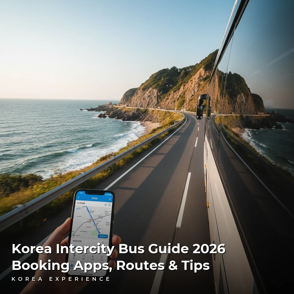
Complete 2026 guide to Korean intercity buses. Compare Express vs. Intercity, master T-Money GO & Kobus apps, and find routes starting from ₩15,000.
Discover Seoul's best-kept secrets beyond Myeongdong. From art hubs in Mullae (₩5,000 coffee) to sunset views in Huam-dong, explore the city like a local.